 AlternateApp.com
27 WhatStreet Manhattan NYC Alternatives
- License: Free | Updated: 2016-09-02 | Current Version: 1.0.1 | File Size: 18.27 MB
Published by Islandbit
Published by Islandbit

Rated 3.5/5 by 1.64k users || Free ||
Built for you, the driver. Whether you are behind the wheel of a car, a professional truck driver with profits tied to your time on the road or an RVer exploring the country - CoPilot has got you covered.. CoPilot GPS Navigation is suitable for ages 4+. It's filesize is 70.45 MB.

Rated 4.5/5 by 3.41k users || $1.99 ||
Powerful GPS navigation app with free offline maps. Drive with detailed voice directions and a lot of smart navigation features.. GPS Navigation & Maps is suitable for ages 4+. It's filesize is 154.29 MB.

Rated 4.3/5 by 16.64k users || Free ||
Get where you need to go with the MapQuest turn-by-turn GPS Navigation app. Whether it’s using voice navigation for walking or driving directions or exploring points of interests on the map, MapQuest has the tools you need to navigate the United States and Canada.. MapQuest GPS Navigation & Maps is suitable for ages 4+. It's filesize is 69.71 MB.

Rated 3.6/5 by 1.17k users || Free ||
Welcome to the new HERE WeGo. HERE WeGo is a free navigation app that guides local and global travelers on journeys both familiar and foreign.. HERE WeGo Maps & Navigation is suitable for ages 4+. It's filesize is 79.62 MB.

Rated 4.6/5 by 48.30k users || Free ||
Sygic GPS Navigation & Maps is the world’s most advanced navigation app. Lots of smart navigation features, beautiful 3D offline maps and easy to use interface provide exceptional navigation experience.. Sygic GPS Navigation & Maps is suitable for ages 4+. It's filesize is 144.04 MB.

Rated 4.6/5 by 21.28k users || Free ||
Live bus and train times, step-by-step navigation, stop announcements, service alerts and more - all in one app. ► Live directions – plan your trip with up to five ways to your destination ► Share your journey details with friends and family - they don't even need the app.. NYC Transit is suitable for ages 4+. It's filesize is 32.69 MB.

Rated 3.2/5 by 180 people || Free ||
The simplest way to find out if your NYC Subway, Long Island Rail, Metro North or NYC Bus is delayed and find the trains near you. Features: - Know when your next train is coming with countdown clocks.. Train Delay NYC is suitable for ages 4+. It's filesize is 24.92 MB.

Rated 4.8/5 by 360 people || $2.99 ||
• NYC subway map works underground without an internet connection (connection only needed to lookup street addresses and get live transit alerts) • Directions without an internet connection displayed right on the map • Very easy to use - All lines and connections shown clearly • 24-hour Day/Night maps - Automatically switches maps at 11pm and 6 am • Pop-up Google street map - Press any station for 3 seconds to see local area • Built-in Compass - Helps with orientation at street-level • GPS Locator - Shows closest subways stations • Transit Alerts - Push notifications of delays for only the lines you choose • Identifies stations with no free cross-over to go in opposite direction • Shows over 350 NYC Neighborhoods and Parks "ONE OF THE TOP TEN NEW YORK CITY-BASED APPS" - Huffington Post "EASIER TO READ" - The New York Times "ONE OF THE BEST APPS FOR NAVIGATING NYC's SUBWAY LINES" - CNET "EASY, DETAILED, AND CLEAR" - Apple Gazette "NAVIGATING THE NY SUBWAY HAS NEVER BEEN EASIER" - Appolicious. com "EASIER TO SEE ALL THE LINES" - Treehugger.. KickMap NYC is suitable for ages 4+. It's filesize is 10.10 MB.

Rated 4.5/5 by 4 people || Free ||
This Lite edition is an ad-supported FREE version of our popular iOS app, CrossWalk HD. ----------------------- CrossWalk is an interactive MTA subway map, transit guide & cross-street calculator for NYC commuters.. CrossWalk NYC Lite is suitable for ages 4+. It's filesize is 13.86 MB.

Rated 5/5 by 2 people || Free ||
This is an app for the MTA L train. It uses the same data as the real countdown clocks on the platform.. L Train NYC is suitable for ages 4+. It's filesize is 1.12 MB.

Rated 5/5 by 30 people || $1.99 ||
WhatStreet is an app that tells you what street you are on and updates the simple view every time it changes. It also speaks out the street name - even in the background mode.. What Street? is suitable for ages . It's filesize is 0 bytes.

Rated 4.8/5 by 5.03k users || Free ||
Identify property lines, ownership, land use, vacancy, and more. Get updates when the places you care about change.. The Regrid Property App is suitable for ages 4+. It's filesize is 29.83 MB.

Rated 4.6/5 by 5.42k users || Free ||
An essential app for San Francisco public transit riders. Features include: - Real-time GPS location of buses* - Predicted arrival times at stops* - Find nearby stops by zooming in - Pin frequently used stops on the map *All GPS locations and arrival time predictions are provided by NextBus.. Transit Watch is suitable for ages 4+. It's filesize is 40.29 MB.
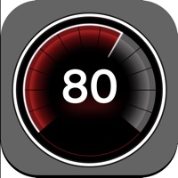
Rated 4.6/5 by 3.69k users || Free ||
GPS - Speed Tracker is a free, simple and elegant speedometer application. GPS - Speed Tracker uses the iPhone's built-in GPS system to show your current, maximum/top and average speed, as well as the heading direction, total distance, trip time and altitude in a single screen.. GPS Digital Speed Tracker is suitable for ages 4+. It's filesize is 46.31 MB.

Rated 4.7/5 by 386 people || Free ||
Measure the elevation of each location within a radius of 500 meter. With Terrain Radar Altimeter you can discover the height of hills in front of you or take a look at further away mountains.. Terrain Radar Altimeter 2 is suitable for ages 4+. It's filesize is 27.18 MB.

Rated 5/5 by 0 users || Free ||
Navmii (formerly Navfree) is a free community-based navigation and traffic app for drivers. Navmii combines voice-guided navigation, live traffic information, local search, points of interest and driver scores.. Navmii Offline GPS Turkey is suitable for ages 4+. It's filesize is 487.29 MB.

Rated 4.7/5 by 4.82 million users || Free ||
Navigate your world faster and easier with Google Maps. Over 220 countries and territories mapped and hundreds of millions of businesses and places on the map.. Google Maps is suitable for ages 4+. It's filesize is 197.36 MB.

Rated 4.9/5 by 2.85 million users || Free ||
Always know what’s happening on the road with Waze. Even if you know the way, Waze tells you instantly about traffic, construction, police, crashes, & more.. Waze Navigation & Live Traffic is suitable for ages 4+. It's filesize is 165.35 MB.

Rated 4.8/5 by 1.15 million users || Free ||
With over 40 million users, ParkMobile is a smarter way to park. Easily pay for street, lot, or garage parking right from your mobile device.. ParkMobile is suitable for ages 4+. It's filesize is 51.43 MB.

Rated 4.6/5 by 215.13k users || Free ||
"Gives you the best route to where you want to go" - New York Times “You won't realize how much time you can save planning until you use this app” - LA Times “Killer app” - WSJ "MBTA has a favorite transit app — and it's called Transit" - Boston Globe Transit is your real-time urban travel companion. Navigate your city’s public transit system with accurate real-time predictions, simple trip planning, step-by-step navigation, service disruption notifications, and departure and stop reminders.. Transit • Subway & Bus Times is suitable for ages 4+. It's filesize is 146.55 MB.

Rated 4.8/5 by 195.14k users || Free ||
Park smarter with the SpotHero iPhone app. SpotHero helps you get everywhere, easier by making it fast and convenient to find and reserve parking in major cities.. SpotHero is suitable for ages 4+. It's filesize is 78.61 MB.

Rated 4.8/5 by 118.60k users || Free ||
The most secure and easy way to pay for fuel and earn rewards. Exxon Mobil Rewards+ app allows you to stay in the comfort of your vehicle while you pay for Synergy™ fuel with your phone.. Exxon Mobil Rewards+ is suitable for ages 4+. It's filesize is 133.36 MB.

Rated 4.8/5 by 118.53k users || Free ||
Take the hassle out of parking with the ParkWhiz app. Find parking in any major city, compare prices, plus save up to 50% when you book in advance.. ParkWhiz is suitable for ages 4+. It's filesize is 74.39 MB.

Rated 4.9/5 by 98.35k users || Free ||
Voted “one of the most innovative hunting products of the decade” by Field & Stream, the onX Hunt App is the must-have tool for the crews at MeatEater, Mossy Oak, and Realtree Outdoors. Know where you stand with the most trusted and accurate GPS satellite and topo maps.. onX Hunt is suitable for ages 4+. It's filesize is 232.84 MB.

Rated 4.8/5 by 96.55k users || Free ||
Avenza Maps, #1 app for hiking, biking and all trails. Featuring maps from National Geographic, national parks and more.. Avenza Maps is suitable for ages 4+. It's filesize is 108.89 MB.
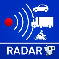
Rated 4.6/5 by 91.24k users || Free ||
The only app that combines real-time alerts with the best offline radar detection alert system. With Radarbot, you will have the best radar alerts, real time traffic alerts and specific speed limit alerts for different vehicles (cars, motorbikes, trucks and commercial vehicles) in one powerful app.. Radarbot is suitable for ages 4+. It's filesize is 64.14 MB.